U.S. Geological Survey — U.S. Department of Energy Cooperative Studies in Nevada
Groundwater Withdrawals
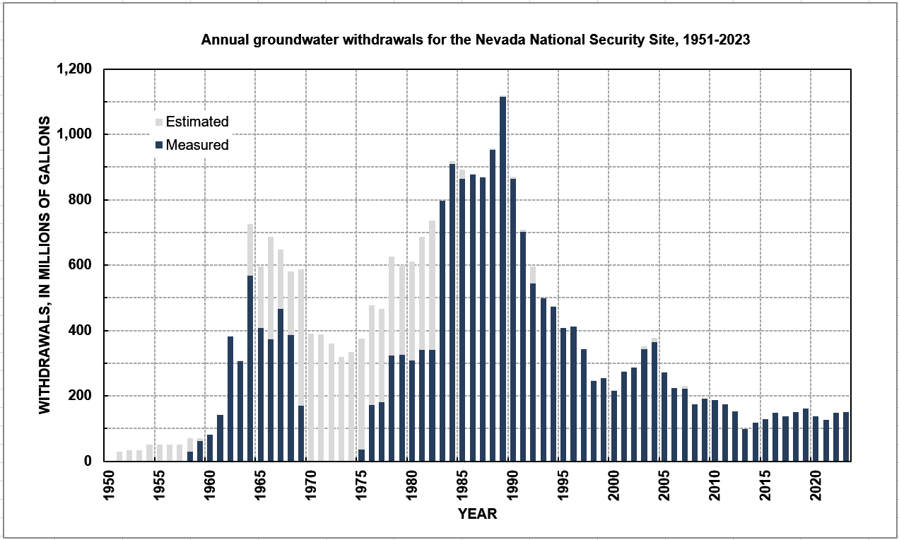
Nevada National Security Site Groundwater-Withdrawal Data-Collection Study
The U.S. Geological Survey (USGS) compiles and maintains groundwater withdrawal data for wells on and adjacent to the Nevada National Security Site. Groundwater withdrawal data are a compilation of measured and estimated withdrawals obtained from published and unpublished reports, U.S. Geological Survey files, and/or data reported by other agencies. Monthly withdrawal data collected from 1951 to present from the wells listed below are available by clicking on the specific well name. Monthly withdrawal data collected from 1951 to 2008 for most of these wells are available in a Microsoft© Excel spreadsheet and a history of each well in terms of its well construction, borehole lithology, and water levels also is provided in Elliott and Moreo (2011).
For More Information
Jeff Sanders
jvsanders@usgs.gov
U.S. Geological Survey,
Nevada Water Science Center
500 Date Street
Boulder City, NV 89005
Phone: 702-294-6052
Regional Groundwater-Withdrawal Studies
The USGS, in cooperation with DOE, developed a regional, three-dimensional, transient groundwater flow model to better understand the groundwater flow system in the Death Valley region (Belcher and Sweetkind, 2010, Belcher and others, 2017, Halford and Jackson, 2020). A spatially and temporally distributed database of anthropogenic groundwater withdrawals was developed in support of the groundwater flow model (Moreo and others, 2003). This database documents regional groundwater withdrawals from 1913 to 1998. Withdrawal estimates were refined and updated through 2003 (Moreo and Justet, 2008) and 2010 and 2016 (Elliott and Moreo, 2018) as part of a continuing effort to improve and update the groundwater flow model.
Available Data
Latest Water Withdrawals
Monthly summary for the previous six months
All Water Withdrawals
To view these wells on a map, return to the home page and choose "water withdrawals" from the dropdown menu under Data Type.