
Carson River Basin
February 1986
Rain/Rain-on-Snow Event
Light rain began February 12, 1986, becoming heavy on February 15 and diminishing by the 20th. The National Weather Service (NWS) Minden precipitation gage reported 5.14 inches of rain. Flooding in Carson Valley caused closure of one bridge on Highway 395. Deterioration of a tributary dam near Dayton during the storm caused temporary evacuation for about 200 residents. Carson River washed away Weeks Bridge on U.S. Highway 95 Alternate.
Selected Streamflow Peaks
| Site ID | Gaging Station | Peak (cubic feet per second) |
|---|---|---|
| 10309000 | East Fork Carson River near Gardnerville, Nev. | 7,380 |
| 10311000 | Carson River near Carson City, Nev. | 13,200 |
| 10312000 | Carson River near Fort Churchill, Nev. | 16,600 |
Photos
No photos available.
Video
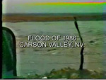
Aerial view of Carson Valley (30 second video clip).
 MPEG (2 Mb) || QuickTime (1.4 Mb)
![]() QuickTime player may be downloaded for free at http://www.apple.com/quicktime/download
QuickTime player may be downloaded for free at http://www.apple.com/quicktime/download
QuickTime and the QuickTime Logo are trademarks of Apple Computer, Inc., registered in the U.S. and other countries. The Get QuickTime Badge is a trademark of Apple Computer Inc., used with permission.
