
Carson River Basin
January 1997
Rain-on-Snow Event
In December 1996, several moderate to heavy snowstorms built up a large snowpack (more than 180 percent of normal) in the higher altitudes of the Sierras with two to three feet on the valley floors. A series of three subtropical storms originating in the central Pacific Ocean brought heavy rainstorms to the region (named "The pineapple express" for the moisture-laden, subtropical jet stream originating in the central west Pacific Ocean). The last of these storms moved through the region from late December 30, 1996, to early January 2, 1997. These storms brought heavy, unseasonably warm rain to the Sierras.The heavy rains melted almost 80 percent of the snowpack in the Sierra Nevada below about 7,000 feet in altitude and produced heavy rainfall up to 10,000 feet in the mountains, contributing heavily to the runoff (USGS, 1997; NBMG, 1998). Recorded precipitation was 16.4 inches at the Natural Resources Conservation Service (NRCS) Ebbetts Pass SNOTEL (SNOwpack TELemetry) site (8,700 ft) and 3.5 inches at the National Weather Service (NWS) Minden precipitation gage (4,710 ft).
About 53.2 square miles of the Carson River Basin were flooded during the 1997 flood. West and north of State Route 88, floodwater from the East Fork spread laterally over an extensive area of central Carson Valley and joined floodwater that was spreading northward and eastward from the nearby West Fork. The combined floodwater formed a lake across the valley floor 2 to 3 feet deep, overflowing Muller Lane. Downstream the floodwater flowed north past the normal confluence of the East and West Forks, northeast of Walley’s Hot Springs, and northward over Genoa Lane. Some homes and part of the Genoa Country Club sustained damage from the flood as some areas were submerged in 2 feet of water. Floodwater from the mountains and alluvial fans along the western side of Carson Valley contributed to the existing flow. About one foot of water covered Highway 395 near Cradlebaugh Bridge which has been damaged numerous times in the past during floods.Downstream the floodwater flowed northward towards Empire (east side of Carson City). The Carson River turns abruptly east and enters a narrow canyon after being joined by floodwater from Eagle Valley. Large areas of Carson City were flooded, particularly those on or near the toes of the alluvial fans around the uplands of Eagle Valley, and the lowlands along major drainage routes. Specifically, serious flooding occurred along Kings Canyon Creek, Vicee Canyon, and Ash Canyon. As the floodwater emerged from the Brunswick Canyon area two miles upstream of Dayton, the floodwaters spread over a quarter to half mile wide alluvial floodplain causing damage to some farms, ranches and homes upstream of Dayton. A mobile home park immediately downstream from Dayton was flooded as was the Dayton State Park. In addition about 30 homes in the River Valley subdivision were flooded. Through approximately a 6-mile reach through the Carson Plains, the Carson River flooded an area averaging a half mile in width parallel to the river. Flood depths in this area ranged between 2 to 4 feet. Downstream from this reach there is little development so damage was relatively minor.
Map of areas affected by 1997 flooding (PDF format, 1.2 Mb) provided by Nevada Bureau of Mines and Geology.
NOAA GOES satellite image of the December 31, 1996 storm.
Selected Streamflow Peaks
| Site ID | Gaging Station | Peak (cubic feet per second) |
|---|---|---|
| 10309000 | East Fork Carson River near Gardnerville, Nev. | 20,300 |
| 10311000 | Carson River near Carson City, Nev. | 30,500 |
| 10312000 | Carson River at Fort Churchill, Nev. | 22,300 |
Photos
Videos
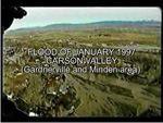
Aerial view of Minden and Gardnerville Areas (30 second video clip).
 MPEG (3.2 Mb) || QuickTime (3.5 Mb)
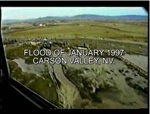
Aerial view of Carson Valley from Minden along the west side (30 second video clip).
 MPEG (3.1 Mb) || QuickTime (3.0 Mb)
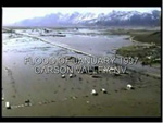
Aerial view of Carson Valley south from R.V. Park on Highway 395 (30 second video clip).
 MPEG (1.9 Mb) || QuickTime (1.6 Mb)
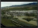
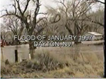
Aerial view of Dayton (30 second video clip).
 MPEG (2.5 Mb) || QuickTime (2.3 Mb)
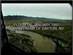
Aerial view of Dayton along the Carson River (30 second video clip).
 MPEG (6.0 Mb) || QuickTime (6.1 Mb)
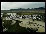
Aerial view of Carson Plains area downstream of Dayton (30 second video clip).
 MPEG (6.0 Mb) || QuickTime (6.1 Mb)
Aerial view of Carson Plains area downstream of Dayton (30 second video clip).
 MPEG (4 Mb) || QuickTime (4 Mb)
![]() QuickTime player may be downloaded for free at http://www.apple.com/quicktime/download
QuickTime player may be downloaded for free at http://www.apple.com/quicktime/download
QuickTime and the QuickTime Logo are trademarks of Apple Computer, Inc., registered in the U.S. and other countries. The Get QuickTime Badge is a trademark of Apple Computer Inc., used with permission.
